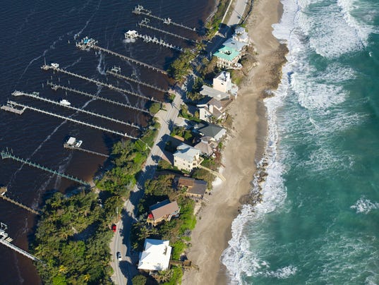
Treasure Coast and Space Coast property owners now can find out if their flood insurance premiums are likely to increase next year.
Six years after initiating a review, the Federal Emergency Management Agency earlier this summer released draft updated coastal hazard flood maps.
The flood insurance rate maps — which last were updated more than 40 years ago — evaluate storm-surge risk in coastal areas and are used to determine flood insurance costs, according to FEMA.
The lower your flood risk, as indicated on the maps, the lower your flood insurance premiums.
Flood insurance premiums vary widely, ranging from about $400 in low-risk areas to up to $2,500 in high-risk areas, such as some portions of Florida’s coast. Flooding is not covered by standard homeowner insurance policies, and homeowners in some high-risk areas are required to have it, FEMA said.
Some county officials say that, based on a preliminary review of the maps, there appears to be good news for most homeowners.
“It seemed like there is more acreage coming out than going in” to flood-risk zones, said Stan Boling, Indian River County community-development director.
Boling said most of the changes to the maps are the result of new development practices.
The new maps seem to indicate “a lot of structures being elevated through more modern development processes and standards,” Boling said.
In Martin County, for the most part, the base flood-elevation levels established on the maps are lower than they were previously, according to Martin County Engineer Lisa Wichser.
However, she noted, that’s not the case for all areas, and some property owners could see their insurance premiums increase.
Base flood elevation is the level to which water is expected to rise during what FEMA calls the base, or 1 percent chance, flood.
An examination of Martin County’s preliminary maps seems to indicate that FEMA puts the southern areas of the county in more danger than they were previously and the northern area in less.
Still, because the flood insurance rate maps divide the Treasure and Space coasts into hundreds of parcels and evaluate each individually, it is difficult to draw sweeping trends, according to county officials.
Brevard County “has yet to make any quantitative assessment … regarding the number of properties which may be affected,” said Kimberly Prosser, Brevard County Emergency Management spokeswoman.
St. Lucie County said it has initiated its review and has organized the data into an interactive map, available to the public online.
The new maps incorporate updated topography based on LiDAR — or light detection and ranging, which uses a pulsed laser to measure topographic data — new climate data based on recent storms and “vastly improved computing resources,” according to Danon Lucas, spokesman for FEMA region 4, which includes the southeastern United States.
Storms analyzed included Irene, Frances, Jeanne, Tammy and Wilma, according to FEMA.
“The most important thing to know is that people living in coastal communities will have a more accurate picture of their flood risk,” Lucas said. “Flood risk assessment is better than ever.”
FEMA declined to draw any major trends along the Space and Treasure coasts.
The study was restricted to areas on or near the coastline. In Brevard County, for example, the study was conducted along the barrier island, Merritt Island and inshore areas of the Indian River Lagoon.
Still, the maps are not final.
Next month, Treasure and Space coast property owners will have a chance to sit down with FEMA officials at a series of public meetings. The public will have the chance to weigh in on the changes during a subsequent 90-day comment period.
Wichser noted the importance of the meetings and comment period.
“This is the opportunity for the community and officials to submit any concerns they may have in regard to the new maps,” Wichser said.


